This story originally appeared in Open Source, our weekly newsletter on emerging technology. To get stories like this in your inbox first, subscribe here.
The world is a vast and ever-evolving tapestry. Businesses and homes in neighborhoods come and go, and so do roads, buildings, among other things that are built. This often leaves us grappling with the Herculean task of putting together an accurate and current map of the world.
Maps used today are a far cry from their predecessors. For over a millenia, we’ve continuously innovated new and novel ways of navigating the world. We’ve read the stars, followed landmarks, used stone and later paper maps, before finally settling on digital maps, at least for now. Adios sextants and atlases, hola GPS and apps, we said.
This evolution may simply reflect the world changing with the times, though it should also be viewed as an outcome of the change in what maps mean to us. While maps have, for the longest time, been used primarily to navigate from one point to another, contemporary versions must fulfill a panoply of objectives that extend beyond that.
Modern cartography is about more than mere navigation
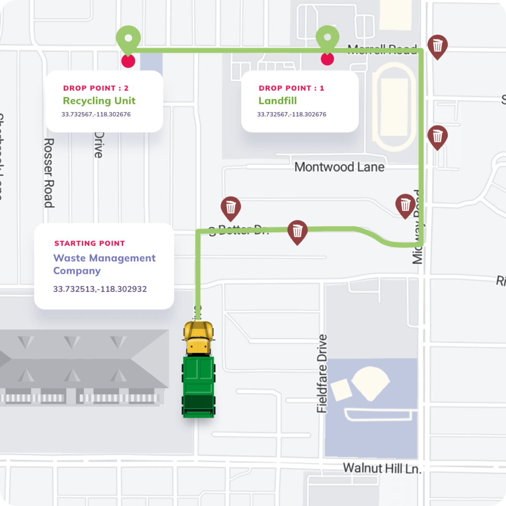
In the waste industry, maps play a crucial role in assisting refuse collectors as they navigate intricate and often-changing networks of waste collection points. You could try to accomplish this using a consumer-focused map app like Google Maps, but you probably shouldn’t. Unlike the typical one-stop journey the average user takes, refuse collectors often need to traverse numerous collection points—sometimes in the hundreds—within a single trip. Planning such journeys using consumer-focused map apps, whether it’s Google Maps or region-specific alternatives like Baidu Maps (China) or Naver Maps (South Korea), would unequivocally be a rigorous task—they are simply not built for route planning at that scale.
This holds true in other industries too. In last-mile logistics and supply chain management, operational efficiency and on-time delivery are contingent on using maps that can track the locations of fulfillment operators in real time, facilitating route optimizations. Likewise, within ride-hailing apps, effective driver-passenger matching depends on accurately determining and interpolating their locations onto an integrated map service, enabling drivers and passengers to rendezvous based on their physical proximity.
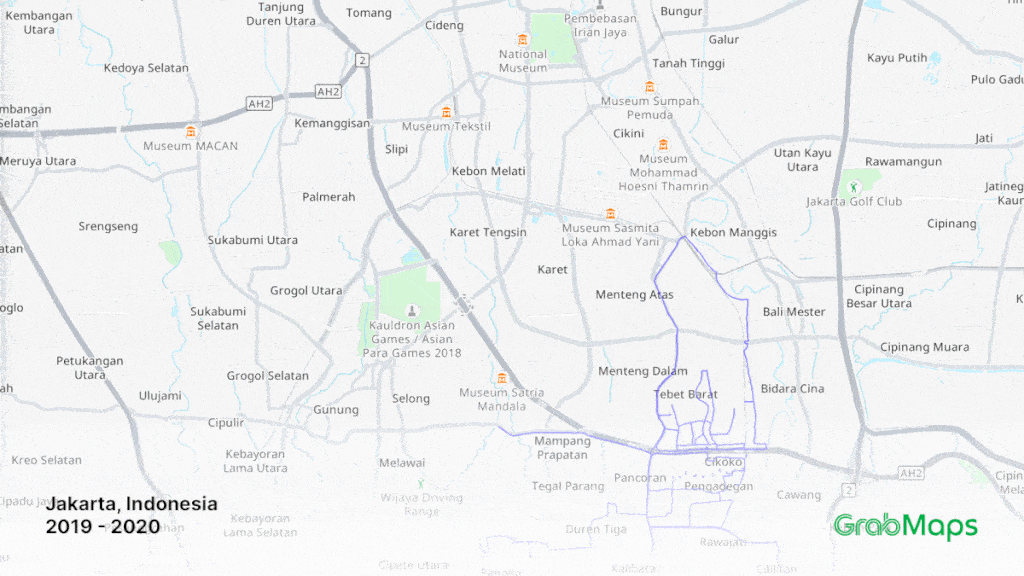
Singapore-based tech giant Grab saw this as a problem worth solving. Both its delivery and ride-hailing arms rely on maps to be able to serve customers, so it made perfect sense to build GrabMaps, a map platform of its own. Since launching it in June 2022, the company has also onboarded Amazon Web Services as a GrabMaps client, underscoring the business potential of mapping technology.
This transition from wayfinding to location-based optimizations marks a pivotal phase in the evolution of maps. As technology and our understanding of geography advance over time, maps have evolved accordingly. Satellites, sensors, and increasingly sophisticated software enable maps to be updated quicker—sometimes down to the second—to reflect changes in terrain, infrastructure, and other geographical features in a precise fashion.
This rapidly iterative nature has been instrumental in expanding the scope of maps to accommodate additional features like the ones described for the waste, logistics, and ride-hailing industries. And that’s just the beginning. As it turns out, when maps can offer accurate real-time data, plenty of applications become feasible, albeit with a catch: there’s no one-map-fits-all solution.
Mapping the world for a billion people
Mapping is a game of balance. Cover too much ground, or integrate too many features, and any map becomes unwieldy for users, slow to load, and cost-ineffective for businesses to operate. Ask the co-founders of Nextbillion.ai—Ajay Bulusu, Gaurav Bubna, and Shaolin Zheng—and they will likely attest to that. All three of them worked at Grab and were core members of the team that developed GrabMaps before they left in 2020 to launch the startup.

Their departure stemmed partly from realizing the finite potential of off-the-shelf maps in meeting evolving customer expectations. Grab faced this challenge. Before it released GrabMaps, the company spent years running its services off of OpenStreetMaps, a freely available geographic database. There were teething issues that it never managed to fully resolve. This unfolded during the period when ride-hailing—Grab’s sole core business at that time—was still nascent, which meant ready solutions were scarce, if not non-existent. Ultimately, this led to the development of GrabMaps.
But that’s just one part of the story. Nextbillion.ai began with the initial goal of solving mapping problems, but its focus is increasingly geared toward hyperlocal maps: highly detailed and specific maps that zoom in on a localized area. Maps are used in growingly diverse ways, especially with the digital economy boom. This means that maps often need to have different compositions of data, logic, and interface, tailored uniquely to serve the applications they are integrated into.
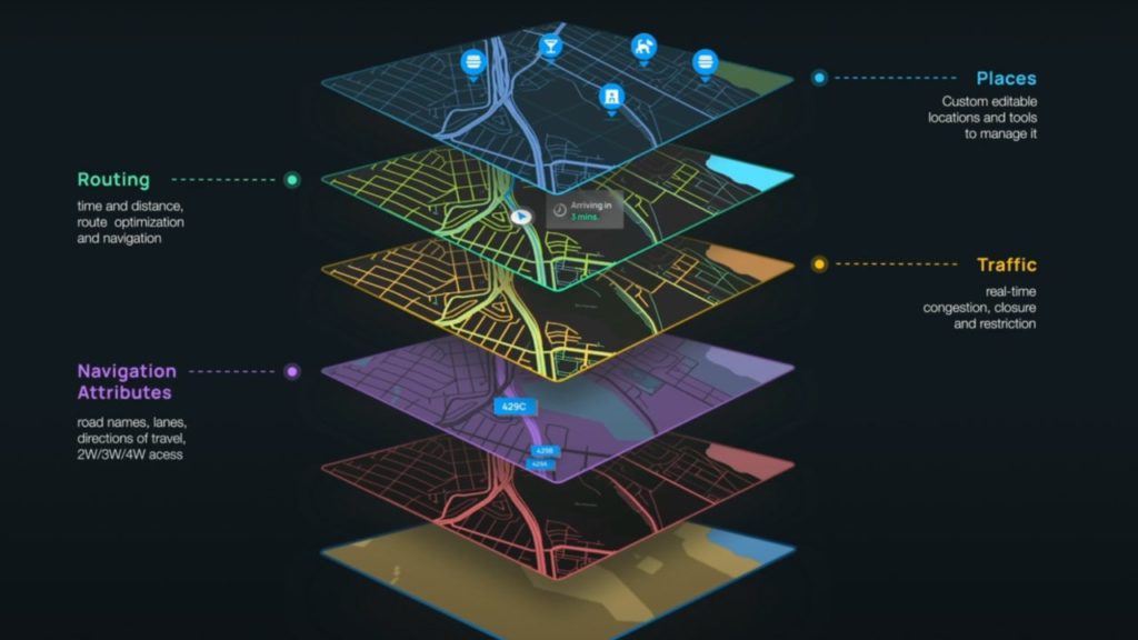
Nextbillion.ai primarily adopts an artificial intelligence-based approach using application programming interfaces (APIs). Through its APIs, it grants developers access to leverage and integrate an array of mapping capabilities into their own applications. This approach promises flexibility and efficiency, enabling businesses to tailor mapping solutions to their specific needs in lieu of adopting a nondescript alternative.
When things get spatial
To characterize Nextbillion.ai as a company that builds (or helps developers to build) customizable maps would be valid, but imprudent. What’s worthwhile to note is that the company describes itself as a spatial data platform, which we believe is for good reason.
Advanced technology such as digital twins, augmented and virtual reality (AR/VR), self-driving vehicles, and more, are fast-growing but also intricately complex in their infrastructural requirements. Spatial data is content-rich and difficult to manage, and has to be accessible at a cadence commensurate with such requirements.
While working with a spatial data platform may not single-handedly resolve all challenges associated with the development of such advanced technology, it would serve as a linchpin in some instances, lightening the load of developers. They could do away with manually identifying ways of collecting, synchronizing, and integrating spatial data from various sources. There may also no longer be a need to craft custom integration code from scratch.
Developers can also shift their focus toward perfecting the functionality of their applications and refining their unique value propositions. We’re speculating, but in essence, Nextbillion.ai’s platform could eventually become a catalyst, providing a strong foundation for developers working on applications that require spatial data to operate.
Safe to say, maps used today are a little more spatial special than their predecessors.
If you enjoyed reading this, you might also be interested in:
- Ola levels up its new mobility play by acquiring geospatial services startup GeoSpoc (by Moulishree Srivastava)
- Quanxun Spatial Intelligence is commercializing precision geolocation technology (by KrASIA Connection)
- Most popular Chinese navigation app AutoNavi apologizes for faulty routing (by Stephanie Pearl Li)
- Gojek hints at new integrated map service called GoTransit (by Ursula Florene)